
Garmin GPSMAP 79s
4.2Editor score
Rugged floating design
Worldwide basemap included
Up to 20 hours battery
Navigating the open water requires reliable technology to ensure safety and efficiency on every journey. Modern marine GPS units combine precise positioning with advanced sonar and mapping capabilities. Choosing the right device helps you avoid hazards and find your favorite fishing spots with confidence.
We evaluated ten leading marine GPS units based on display quality, mapping features, and connectivity options. Our analysis considers both handheld devices and fixed chartplotters suitable for various vessel sizes. Each product offers unique strengths tailored to specific boating and fishing needs.
Each pick in this guide highlights key specifications and real-world performance characteristics for informed decisions. Prices and availability may change frequently so verify current details before purchasing. Use this resource to find the perfect navigation system for your next adventure on the water.
4.2Editor score

4.7Editor score

5.0Editor score
As an Amazon Associate we earn from qualifying purchases.
Explore the detailed side-by-side comparison of the top marine GPS units available today. Each entry highlights core specifications and key capabilities to help you compare options quickly.

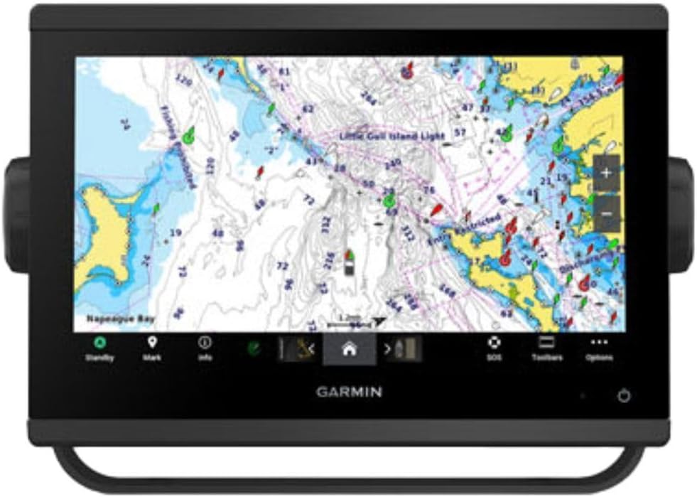


The Garmin ECHOMAP UHD2 94sv stands out as a top-tier marine GPS unit with a 9 inch bright touchscreen. It holds an impressive 4.7 rating from users who praise its clarity and ease of use on the water.
We may earn a commission when you buy through this link, at no additional cost to you.
This chartplotter includes the GT56 transducer providing traditional ClearVü and SideVü scanning sonar capabilities. The included Navionics+ coastal charts offer detailed mapping for US coastlines ensuring you never lose your way during navigation.
While the price is higher than entry-level models the performance justifies the investment. You may need to purchase radar separately which adds to the total cost for full situational awareness.
Ideal for serious boaters and anglers this unit delivers reliable navigation and fish finding in one device. Its wireless connectivity features allow seamless data sharing across multiple devices on board.
The GT56 transducer enables high resolution sonar views that help identify fish and structure clearly.
Wirelessly connect to Force motors or share waypoints with other ECHOMAP units effortlessly.
We may earn a commission when you buy through this link, at no additional cost to you.
The Simrad GO Chartplotter offers essential navigation features at a competitive price. It holds a solid 4.4 rating making it a popular choice for small to mid-sized boats seeking reliable GPS.
We may earn a commission when you buy through this link, at no additional cost to you.
It comes with a preloaded C-MAP Discover chart card including vector charts and bathymetric contours. The HDI transducer supports clear CHIRP sonar and DownScan Imaging helping you locate fish below.
While it lacks premium display optics the functionality meets basic needs. Radar is optional so full scanning capabilities require extra investment.
This unit suits sportboats and center consoles needing essential GPS and sonar. Its connectivity options ensure future proofing as you expand your marine electronics setup.
Included vector charts offer detailed depth shading and contour lines for precise navigation.
Mirror the display to a tablet for extended viewing comfort on board.
We may earn a commission when you buy through this link, at no additional cost to you.
This premium unit delivers unmatched clarity with a 12 inch touchscreen and top ratings. It holds a perfect 5.0 rating indicating high satisfaction among users who demand excellence.
We may earn a commission when you buy through this link, at no additional cost to you.
The 5000 watt CHIRP sonar provides deep water target separation unmatched by lower power units. Worldwide basemap coverage ensures navigation support from coastal areas to inland rivers globally.
The cost is significant and the size requires substantial dashboard space. However for serious cruisers the performance and reliability justify the expense.
Choose this model for large vessels needing maximum situational awareness. Its robust networking capabilities integrate seamlessly with other high-end marine systems.
IPS panel ensures vibrant colors and viewing angles even in direct sunlight.
J1939 connectivity allows monitoring engine data directly on the chartplotter.
We may earn a commission when you buy through this link, at no additional cost to you.
This chartplotter focuses on delivering high quality sonar views. It holds a 4.7 rating for those seeking detailed imaging capabilities on the water.
We may earn a commission when you buy through this link, at no additional cost to you.
Ultra high definition scanning sonar provides crisp images of underwater terrain. Pre-loaded mapping helps you navigate immediately upon setup without extra purchases.
Users should note that a transducer must be purchased separately. This increases the initial cost but allows for flexibility in sonar choice.
Best for anglers prioritizing fish finding over basic navigation. The improved optics ensure clarity even in challenging lighting conditions.
Supports advanced Panoptix transducers for real-time underwater viewing.
Improved optics provide sharp visuals for easy reading while underway.
We may earn a commission when you buy through this link, at no additional cost to you.
This handheld model offers essential tracking at a budget-friendly price. With a 4.2 rating it serves as a reliable backup or primary unit for small boats.
We may earn a commission when you buy through this link, at no additional cost to you.
It floats if dropped in water and resists moisture with IPX6 rating. The worldwide basemap provides coverage globally without needing regional updates.
Detailed charts are not included so plan routes accordingly. The compass is tilt-compensated but may lack advanced navigation features.
Ideal for casual boaters needing emergency navigation or backup GPS. The battery life ensures extended use without frequent recharging.
Fogproof glass and scratch-resistant screen protect against wear and tear.
Up to 20 hours in GPS mode ensures all-day operation.
We may earn a commission when you buy through this link, at no additional cost to you.
This unit stands out by including detailed BlueChart g3 coastal maps out of the box. It holds a 4.0 rating offering a balance of mapping and rugged utility.
We may earn a commission when you buy through this link, at no additional cost to you.
The built-in altimeter tracks pressure changes helping predict weather shifts. A tilt-compensated compass ensures accurate heading readings even when the vessel moves.
While it lacks fish-finding features the navigation tools are robust. The chart coverage helps avoid shallow waters and hazards during coastal trips.
Best for kayakers or small boat owners prioritizing navigation depth. It provides critical data without requiring extra map purchases.
Barometric altimeter aids in weather forecasting while on the water.
BlueChart g3 offers rich detail for safe coastal navigation.
We may earn a commission when you buy through this link, at no additional cost to you.
This model includes a radome for full radar coverage right out of the box. It represents a high-end system for larger vessels requiring extensive navigation tools.
We may earn a commission when you buy through this link, at no additional cost to you.
OneHelm digital switching allows third-party device integration for better boat control. Preloaded Navionics+ charts simplify initial setup for coastal trips.
The setup complexity requires technical knowledge for full utilization. This limits accessibility for casual users without marine system experience.
Best for commercial or large recreational boats. The remote control capabilities enhance safety and efficiency during navigation.
Included radome ensures immediate radar situational awareness on board.
Connects to digital switching for centralized boat management.
We may earn a commission when you buy through this link, at no additional cost to you.
This mid-range option offers a 10 inch screen combining GPS and fish finding capabilities. It holds a 4.7 rating for reliability and ease of use.
We may earn a commission when you buy through this link, at no additional cost to you.
The included basemap provides basic navigation without needing extra data. While the transducer is separate the unit is ready for immediate chart plotting.
Missing transducer may require additional expense for full fish-finding utility. However the display quality remains strong for navigation tasks.
Suits average boat owners needing a reliable dual-purpose unit. The brand reputation ensures consistent performance and support.
10 inch screen offers clear visibility without overwhelming the dashboard.
Combines essential navigation and fish finding in one unit.
We may earn a commission when you buy through this link, at no additional cost to you.
This handheld is a classic option for basic navigation needs. It holds a 4.6 rating for accuracy and straightforward operation.
We may earn a commission when you buy through this link, at no additional cost to you.
WAAS enablement ensures precise positioning for safe coastal trips. The trip computer tracks speed and distance helping manage boat time effectively.
Memory is limited requiring optional discs for detailed maps. The interface is functional but lacks modern color displays.
Best for backup navigation where simplicity is valued. Its proven reliability ensures you know where you are at all times.
WAAS correction provides precise positioning for safer coastal travel.
Standard AA batteries provide up to 16 hours of operation.
We may earn a commission when you buy through this link, at no additional cost to you.
This unit focuses purely on navigation with high-quality mapping data. It holds a perfect 5.0 rating from users needing dedicated chart plotting.
We may earn a commission when you buy through this link, at no additional cost to you.
The included Navionics+ charts offer detailed views of waterways and coastlines. Improved optics ensure the screen is readable even in bright sunlight.
Lacking sonar means it won't detect fish below the boat. This makes it suitable for pure navigation or backup plotting needs.
Best for sailors or cruisers prioritizing route accuracy over fishing. Its compact design fits easily on smaller dashboards or consoles.
Navionics+ charts provide high-detail depth and point data.
Small 7 inch screen fits on tight console spaces easily.
We may earn a commission when you buy through this link, at no additional cost to you.
Selecting the right marine GPS requires understanding key features like display size, sonar capabilities, and chart compatibility.
Larger displays offer better visibility in bright sunlight but consume more dashboard space. Look for high-resolution IPS panels to ensure clarity during daylight hours.
Choose a screen size that fits your console while providing enough detail for navigation charts.
Advanced sonar technologies like CHIRP and SideVü help identify fish and structure with greater precision. Ensure the unit supports compatible transducers for optimal performance.
Prioritize models with built-in sonar if fishing is a primary activity.
Preloaded charts save time and money on initial setup. Verify that the included maps cover your specific region or vessel type.
Select units offering regional or worldwide basemaps depending on your travel plans.
Wi-Fi, Bluetooth, and NMEA 2000 ports allow integration with other onboard electronics. These features enable data sharing between devices like radar or AIS.
Ensure the model supports your existing marine network for seamless operation.
Marine environments are harsh so look for water-resistant ratings like IPX6. Rugged construction ensures the device withstands vibration and salt spray.
Handhelds should float and have rugged casing for safety on smaller vessels.
Fixed chartplotters run on boat power while handhelds rely on internal batteries. Check battery duration if you plan long trips without shore charging.
For handhelds aim for models offering 20 hours of continuous use per charge.
Touchscreen controls offer convenience but physical buttons can be easier to use in rough weather. Test the interface responsiveness before committing to a model.
A well-designed interface reduces distraction while navigating challenging waters.
Higher cost often correlates with better screen quality and advanced features. Balance your financial limit against essential needs like chart coverage.
Invest in core features that match your specific boating habits.
Install your chartplotter where it has clear sky views for optimal satellite signal. Secure cables properly to prevent water damage during heavy rain or splashing.
Update maps regularly to benefit from the latest chart corrections. Use the Wi-Fi connection to download software patches directly to the device.
Clean the screen with a soft cloth to avoid scratches. Store handheld units in a dry place when not in use to preserve battery health.
Many modern units include preloaded basemaps that work without extra cards. However detailed charts require optional upgrades for precise depth data. Check if your model includes maps before purchasing extras.
GPS relies on satellite signals so it needs clear sky views to function. Some handhelds include GLONASS or Galileo support to improve reliability. In tunnels or dense foliage, accuracy may drop temporarily.
Most quality handhelds offer water resistance rated IPX6 or higher. This means they can withstand rain and splashes but might not survive submersion. Always check the manual for specific limits.
Handheld GPS typically last between 15 to 20 hours on a single charge. Fixed units draw power directly from the boat battery for continuous operation. Always carry spare batteries for extended trips.
CHIRP sonar sends a continuous sweep of frequencies for better target separation. Standard sonar uses single pulses which can result in blurred images. CHIRP provides clearer views of fish and structure.
Smartphone apps are useful but often lack durability and dedicated mapping hardware. Marine GPS units offer higher accuracy and better sunlight visibility for navigation. They are safer as primary tools for boating.
The Garmin ECHOMAP UHD2 and Simrad GO units stand out for balanced performance and value. Each model offers distinct features tailored to specific vessel types and activities.
Prioritize display clarity and chart coverage to ensure safe navigation. Match the sonar capability to your fishing needs for optimal results.
Always check current availability and verify compatibility before purchasing. The right GPS will enhance your safety and enjoyment on the water.